Colombia
29-02-2008
Volcaniade
January – February 2008
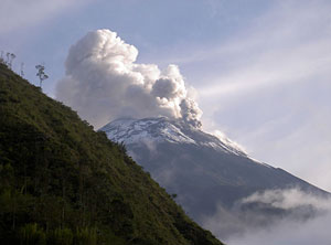
In the first days of 2008, a note1 appeared on my site. It said that the Llaima Volcano in Chile had erupted. Arriving in Colombia several days later, it became clear, that the Galeras Volcano, southern Colombia, had also erupted, throwing up red lava and ash all around. One of the next notes2 gives links to pictures of the Ecuadorian volcano Tungurahua, also in a very heated up state. It is normal for volcanoes to show their mood and nature by proudly spewing fire and brimstone and releasing steam every now and then – without them, the earth definitely would be more boring and monotonous place. As well as without the avalanches, the hurricanes, the earthquakes, and all the rest good and evil, being inseparable part of Earth's wholeness and infinite beauty.
Nevado del Tolima, Colombia, 5200 m, active, last eruption – 1943
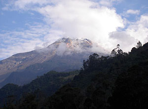
Sometimes, even being well prepared, everything seems to be against you. Such a case was the unsuccessful attempt to scale Nevado del Tolima. At moments I had the feeling of nature playing a chess game, where the human is far less significant than a pawn. One can approach the volcano starting from Ibagué, where just for a day I was able to find people from the local mountaineers' club. They were sure I could find a tent, an ice-axe and crampons at Signora Betti – a notable middle-aged mountaineer, who was just painting her house. These very crampons commanded respect – made by welded steel they looked more like a cold weapon and the tent was a threeperson one, but comparatively light. A week ago, I spent about a day in Bogota searching for bottled gas for a Primus stove, as the usual equipment in Colombia and Venezuela is using the bayonet system for Campingaz. I bought two bottles of ProFuel with threads perfectly fitting to the head of my stove. Following the rule „always try in the lowland what you are going to use in the highland“, I lit up the stove, watching it for a half a minute. I tightened up the crampons, strengthened the tent with a strong adhesive tape and on the next nice morning took the bus for the Juntas Village. One of the challenges of Nevado del Tolima (link) was that Juntas Village is at 2000 m altitude. A sequence of two days lied before me with good climbing of 1500 m that could be a good practice ... but I had already acclimatized myself and supposed that I would not have much trouble. The climate at these latitudes is a function of the altitude (and the season), so I had the unique opportunity to observe the transition from jungle to glacier. At about 7:30 am I embarked on a trip (link) that was supposed to continue for about three days. On the dirt, graveled road, there was no transportation; only two hours later a lonely motorman passed by me; an hour later I was at the geothermal springs at 2600 m. At the springs' entrance a dog, with a triangular head in whose widest part a pair of jaws gaped, greeted me. But scaring dogs out outside Tibet, is a comparatively easy thing. The distance so far was over 10 km. Ahead, the trail entered the steep slope between the trees – I had to use more than my feet points of support. At places, especially where streams flowed, the trail was eaten up; several landslides were a difficult pass, slowly walking in ankle-deep mud. In no time fog fell over the forest – the latter deserved its name – Cloud Forest. A few moments later I reached a 30-40 m waterfall (link). Squeezing myself through dense vegetation while carrying a large-size backpack was not easy and boughs often beat me over my head. Gradually, my feet started to reach wet and slippery stones, and I sometimes walked into small rivulets' beds. I caught up with two Colombians carrying pickels and a tent – they also wanted to scale up the peak tomorrow. It already was 1 pm, I walked slowly and they disappeared in the distance ahead. At about 3 pm I reached the first camp – The Cave (3800 m) and as it was already raining I searched for a more nested place and set up the tent. A creek was murmuringly flowing nearby over several cobbles, where I filled up my bottle and started to cook. The first surprise, out of many, waited for me – the gas burnt for only five minutes and went out. I wondered a bit - the temperature was above zero. Then I noticed that the gas mixture was of isobutane (80%) and propane (20%). As I know, the isobutane is added up for better burning, but the gas in Europe contains far less isobutane (10-20%) and about 50% butane. I do not know if that explained the mystery. Few days later, I repeated the experiment at a lower altitude and at warmer temperatures, without any difference. The gas burnt for about 2-3 minutes and after that the bottle had to stay unused for an hour in order the gas to burn up again. In that way I turned out having no gas, being in a leaking tent while the weather outside was not very promising. The creek, now a river, was just starting to overflow – the water where I filled up my bottle, was now more than tenfold and the waterfall nearby was hellishly roaring – initially I thought Tolima was erupting. I hoped that everything would calm down by 6 pm as usual; I remembered the water level and its power so that to compare them again later. But the problem was not whether I was to reach the crater rim, rather it was how I was to go back. I imagined how the riverbeds and the landslides in the lowland were looking like. I even had the idea to pack everything and to head down the slope under my headlight ... It is difficult when you do not find any acceptable way of acting – after all, I decided to wait and did so until sunset when the elements indeed calmed down. At my last getting out at dusk, I registered a lower level of the rapids. A bit later I slipped into my sleeping bag and into the waterproof bivy sack that was put on the highest place in the tent. I put a towel next to me and fell asleep. However, at about 7 pm it started to rain again and quickly got heavier. Lightnings started to discharge from the sky. I woke up every hour, what was perfect - I mopped the puddles using my towel and squeezed it under the tent's shade. It was not difficult to open my wet eyes at dawn – when I noticed that along lack of hot tea, the whole place around was conquered by minuscule flies, sticking on arms, ears and face. I was beating, sawing the air, and killing them in tens, but hundreds more were landing, so I gave up. Who would have thought, that here, at 3800 m, Autan was needed? It was still raining and the peak was not visible, so I decided not to continue over the slippery rocks toward the glacier, where there would be for sure fresh snow, hiding the crevices. With no gas, I had no desire to wait for good weather. Therefore, I folded the tent, packed my backpack and slowly went down. Due to humidity my watch stopped in the night and at my first fall my pants tore apart along their inner sewing. Wading through a river and holding the unstable fern for support I reached back the waterfall – it looked impressive. Farther down in the forest there were only two new landslides. I was glad when I went back to the snarling dog and the same afternoon I went back to my dry home - “the hotel” in Ibagué. On the next day, the red spots from bites on my arms bloated and swelled so much, that I bought Allergosan. After so many things happened while being on a volcano, you draw the morals and the balance, and head up for the next volcano ...
Puracé, Columbia, 4600 m, active, last eruption – 1977
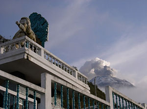
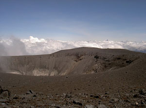
Puracé was a love at first sight – since the moment I saw its picture. This volcano is again in the Cordillera Central and can be easily scaled up for a day. That is I was not about to labour one more time, caring a tent and some gas ... there was not a glacier either, so the usual metal tools were not necessary. The only unforeseeable point in the region (department of Cauca) were the guerrillas, but their presence was considerably subdued due to organizational changes in the Colombian army and the help of the fraternal3 American people. I took a room in Puracé and few moments later there was a downpour. I remembered Tolima with nostalgia, but the next morning the sky was beautiful and blue and clear. At about 6:15 am my landlord gave me a pen-drawn map on wrapping paper and advised me to take the miners' bus to the sulfur mine (~ 3500 m). The travel guides and the Internet say the trail starts few kilometres aside of the mine where you can pay $10 fee for entrance to the national park. I did not wonder whom to believe and departed. The word for a miner has a connotation of seriousness in the Bulgarian language (or at least I have considered the members of this trade as sturdy and sullen people). Colombian miners were a kind of teasing jollies, which were joking all the time. If their colleague took on or off the bus, they pinched his butt, burst into laughter and then hid their hands and looks. The victim turned around and counter-attacked with a remark. In the mining village itself (link) I asked the passengers where the volcano is. The miner who worked somewhere in the same direction took me through the sweet odour of the sulfur. I happened to be on a rugged road reaching the “Antennas” (3900 m) and did not even step aside till its end. In the near past the antennas were frequently sabotaged by guerrillas, so everywhere along the road was mined (link) ... and although the mines were cleared up according to the army, I have decided not to trust them too much. At the beginning I passed by several holes where the sulfur was mined from (link). After that location a view toward the peak appeared, with a large fumarole (fumar – to smoke, Spanish – link) just under the crater. Many turns later, I reached the two lakes, the next reference point on the map, and after a while I stopped for a rest at the antennas. There, a group of 20 paramedics was already having a rest. They offered me tea and after a chat we continued upslope together. The weather was perfect and in the distance above the clouds one could see Nevado del Huila (5700 m – link), that is at least 50 km to the North. We were walking together with the paramedics' guide – first through gently steeping swamps (one should be careful with drinking water near a volcano, as even the cold streams and brooklets under the crater are often unsuitable for the body chemical cocktail), later over rocky slopes, initially steep, then boulders to cobbles, getting smaller and smaller. When the whole upper part of the volcano finally revealed itself, we were stepping into dust, that made advancing slowly, as if we were over a seepage. We neared “the smoker” (link) staying on our right and it became flat in front of us – we were almost at the crater's rim level. Being near a smoke of sulfur compounds, it is smart to know the wind's direction. One not rarely falls in the middle of a cloud of this stinky, heavy, and sweet gas. To breathe is difficult at that altitude anyway, without being into a gas cloud. So in such cases the best to do is to evacuate yourself as fast as possible to fresh air. That is also the reason not to camp near fumaroles. I went around the crater's rim, that is maybe 500 m in diameter (link). Another hole was smoking on its bottom. The rim is rocky and very narrow at places, so the walk over it should be careful. The highest point of the peak is at its southern part. Other views open up there, toward 3 additional craters (link) and to the higher and nearby Pan de Azucar4 (4700 m) – not to be confused with the peak from Cocuy, named the same way. After the tour it became lunch time and Puracé's solid reputation of having very unstable climate turned to be true. The medics' rear-guard was still dragging himself along the last metres under the peak when the blue sky in no time darkened. The descend was comparatively fast and since I stepped on the road behind the antennas, rain, wind and fog were allowed to come. On my way back, I intentionally took a shortcut toward the mine, in order to make the difference. But only 20 minutes later the road finished into a broad hole, eaten up by one more landslide. I could not continue farther, although the road I used to climb up was 200 m aside, across a dewy, green, and soft lawn ... nevertheless I have decided not to shorten my way and legs. I turned back and returned along the distant and round, but safe road.
Cumbal, Colombia, 4700 m, active, last eruption – 1926
The weather was worsening slowly, but tangibly since the middle of January. There were no clear days or such of no rain even in the lowland, although according to the statistics I had still to be in the dry season. Near the border with Ecuador I decided to take my chances at last on Colombian land. I chose the volcano called Cumbal as the most appropriate aim. The approach to the peak starts from a city with the same name, located at the volcano's southeast. According to the local people I first had to reach a school, 2 hours from the city. Considering the distance and the altitude difference, I decided to start at 5 am, at latest, with a headlamp. The early hour made difficult the orientation on the unfamiliar to me terrain. Early birds, who met me in the streets (the first one was deaf), directed me with such words as: “you have to turn left after the first modern house” or “at the Rodriguez's cows – to the right”. I loitered myself for about 3 hours till I reached the school. The twists and the crossings finished at the end, and the trail became only one. The visibility of the mountains ahead decreased, but for the moment there was no chance to lose my way. Even though I met a peasant with a mule, who cut it short - “There are 3 more hours to the top”. The lowland's soil was wet and muddy. In such moments the best is immediately to be ankles-deep in mud or at least to smear some over your pants and jacket. Then you are not going to take too much care about that but to advance freely with a slightly raised head. Fog fell since about 9 am - I was above the Frailejóns5, at near 4000 m - when I started to consult more often the compass and where the trail was interrupted by lawns. I met the old man with the mule one more time, and as a clock cuckoo he said again - “two hours to the top”. I continued through the fog almost all the way to Cumbal and back. I oriented myself by the mule dung ...
During fine weather eyes open up (at least with me) and thoughts stand still. The views, the birds'and brooklets' noise, the wind puff, and the sun's rays are a generous stimulant of the senses, that prevents any other activity except the mechanical and somnambulistic steady walking. In such lovely moments, one drinks the surrounding marvels and charges his or her desire to spend more time in the mountain and nature. If wretched weather is threatening, the eyes are wide opened while the mind snaps and screens options and combinations. Then the person is engaged with his or her own survival and while gaining experience, broadens up his or her limitations – one is getting ready for his or her next travels. If the weather is bad but not that much, not importunate, the mountain seems to me a close moody person – the important is we are together and there is no difference between walking that way for 15 minutes or for 5-10 hours. The time, distances, sky and earth all blend in one, together with the white nuances of the fog and the rain drops.
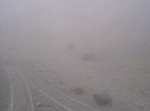
I understood I am in the upper part of the volcanic cone when the soil became dusty; few moments later I saw several deserted handbarrows. The local Indians, whose work day passes above 4500 m, use them to carry the sulfur from the crater's rim down to the place where mules can climb. Instead of a wheel, the barrows slide over wide wood edges through the volcanic ash – their marks are similar to skis' rails in fresh snow (link). I quit using the compass and took these marks, despite of the strong wind that appeared. It also became cold, as it is usually only in the night, but my gloves and hat helped to some extent. An hour later I was just beneath the rim – the earth was yellow-coloured and the barrow marks finished in front of several wide and smoking holes (link) next to which a pick and a shovel were laying down. I climbed up 20-30 metres more over a seep and stopped in front of something big and gurgling, with an unclear shape. I have no idea how close I was to the highest point, but that has not any significance. Instead of looking toward Ecuador or at least seeing the next Chiles Volcano I saw only the barrow marks few metres away – that was sufficient to me. There was nobody around and I wondered where the Indians, usually working here, are - I saw them in the city later in the evening. It was Saturday and tourists were climbing the mountains, while the labourers, sulfur smelling, were descending to the lowland for shopping, a match, drinking, and their humble portion of weekly happiness.
Chimborazo, Ecuador, 6300 m, extinct
After traveling in Venezuela and Colombia I had to try a bit from the Andes of Ecuador too. Ecuador seemed well-organized and definitely more touristic than the other two. Even, at the basements of the frequented peaks there were mountain huts. It was easy to find mountaineering equipment in Quito and the tourists influx to the local volcanoes was comparatively big. Generally, most of them arrive at noon along with their guides, driving jeeps, take a rest for a few hours, scale up the peak during the night, and depart on the next morning in order to catch up with the next hut at the best time for the next peak ... In that way their schedule was bespattered to say, by four volcanoes a week, and another week for the Galapagos Island, with the ultimate aim to gather maximum big basket of impressions, as if meticulously accounted for a period of three-week holiday. I understand those people, but being lazy, I prefer to spend a whole week in just one village instead of spending a day or two on each of three different continents. Having all that in mind I took the way toward the Chimbo's basement (link). The local intercity transport dropped me at a branching ... ten minutes later a tourist bus full of Germans arrived, and stopped 50 m away in apparent hesitation. It started to snow before the end of the asphalted road and several cars refused to continue upslope. It took me about half an hour from the Carrel Hut (with a parking at 4850 m – link) to the Whymper Hut (5000 m – link) along a trail scattered by memorial stones. The huts' names come from the alpinists made the first and the second ascend to Matterhorn, Chimbo, and maybe a dozen other peaks. Most of the memorials were snow-covered and the names chiseled on them were not visible. Not many come here in February – the best climbing season is from October to the middle of January. Then the weather is colder but much clearer and with less fog and precipitation. The last group had left the same day in the morning and as I had the choice I took the only single and small room. The hut keeper, Washington, and two Indian “Sherpas” were my only mates. The Indians were bringing up the wood and the gas for the hut. In spite of that the stove burnt only for an hour or two a day and I had to care not to have many wet clothes. It was my first sight of snow on the equator – it snowed during the whole first day – watery, heavy and damp, it was quickly turning into slush at the comparatively high for 5000 m temperature. It continued snowing the same way on the second day. The slopes adjacent to the glacier were already completely white. Even at 6 - 7 in the morning, when the weather was supposed to be the finest, there was no view to the heights, at least to make judgment of the critical places. I took the ice-axe and put on the crampons at the hut and went to have a look of the two alternative trails. I also brought red spray with the intention to mark my way and the passages over the glacier for my night ascend. The continuous snowing hindered my otherwise good idea. The Ecuadorian friend of Dimitar Domosed – Pepo, has advised me to take the Whymper route (not the “usual one” passing through El Castillo – link), so I followed the advice in the beginning. I barely reached a place next to a big cliff, about 300 m above the hut, by scratching my crampons over the rocks and leaning on the pickel. From that point onward the things became dubious, and there was no visibility ... I went back to the Whymper hut at about 10 am and snailed up along the other side. The trail was passing by a lake and went on along a gentle slope, but from almost the same altitude (~ 300 m above the hut) I came back again. I had no desire to wander across those hills in the afternoon – there was not enough snow for an avalanche to fall, but the snow was loading the precarious rocks above me and the rockfall hazard was real. It was snowing two or three days, but as the temperatures were high, the whole snow cover around the hut was hardly 30-40 cm. There should have been more than half a meter fresh snow cover at higher locations on and above the glacier, immediately under the summit. Gradually, the idea not to go at all shaped in my mind, but nevertheless, before going to bed, I packed up my backpack with all necessities and set the alarm clock for 11 pm. I laid down at 5 pm, but only half an hour later a group came in the hut and settled down in the next to mine room. I got up to see how it was with them. They were four Russians, who had climbed Cayambe (5700 m) and Cotopaxi (5900 m) in bad weather conditions few days earlier. Only in five minutes two of them managed to start a scuffle, discussing which functional regime to use of their headlamps.
Initially I was glad that if there was a chance I would not ascend alone, but later I thought about the merits of changing my mind only for being in a group ... a group of strangers. The Russians possessed experience gathered on Everest, Communism, Lenin peaks, and so on, but the only adviser remains the common sense, isn't it? I talked with the Russians' guide for about 10 minutes and his concluding words were - “Chimborazo is not as the other peaks. We are not going to ascend in so much snow. I am married and have kids – they are more important than that rubbish.” After all the alarm clock woke me near 11 pm, and the weather was more or less clear. The Russians were talking, swearing, and wondered whether to hurry up without their guide. Only well adapted to the climate people and in sound condition can afford to start later than 2 am, as the risk to come back in the afternoon is real. When I woke up again near 2:30 am and saw the Russians' helmets in front of the dining hall, I realized they had given up too. It was snowing again and the view outside was not farther than the toilet. On the next morning I was able to take the only more panoramic Chimborazo's pictures (link). The weather between 6 and 6:30 am was quite clear for the season, but only 20 minutes later the view disappeared, the sky got hidden and the white clouds swallowed up everything around (link). The snow continued to fall heavy, watery and slushy and I swore off that these were my last Andes for 2008. I spent few more weeks in Ecuador, took pictures of Tungurahua (link – link – link), and although it was hard, I kept my oath ... at least so far.
1. A note in Bulgarian, from 04.01.2008, concerning the 1st of January, 2008, eruption – this footnote is by the translator.
2. Notes in Bulgarian, from 08.02.2008 and 22.02.2008 (Waroshanov's original picture link), concerning the 6th of February, 2008, eruption and the following activity – translator's note.
3. During communist times in Bulgaria all newspapers were referring to e.g. the help to Angola by the “fraternal USSR people”.
4. Bread of Sugar – translator's note
5. Genus Espeletia, endemic to Colombia, Venezuela and Ecuador mountainous plants – translator's note.

